| Main Menu | |||
|---|---|---|---|
|
| Services | ||||||||
|---|---|---|---|---|---|---|---|---|
|
|
|

| Filter A-Z by Artist |
|---|
| A B C D E F G H I J K L M N O P Q R S T U V W X Y Z |
| Login |
|---|
|
|
|
|

|
|

|
|


Home  Artists A-Z
Taylor, George
From Castle Island to Killarney & f
Artists A-Z
Taylor, George
From Castle Island to Killarney & f
 View Full-Size Image |
From Castle Island to Killarney & f |
|
| Artist: Taylor, George |
Media: B/W |
|
|
|
||
|
|
||
| SKU: KMP0001656 | ||
| More from this Artist |
||
| About this artist | ||
| Price: €59.95 | ||
|
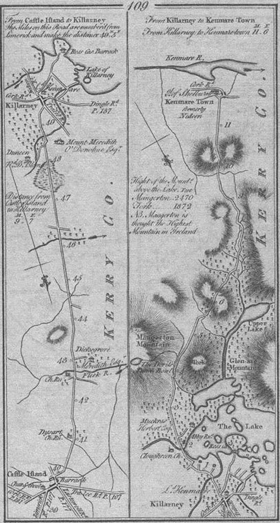
Details: Map - Antiquarian. B/W. 1778. 1st edition thus~33 x 23 cm. (mounted)~(109) Two road maps, the first from Castleisland south to Killarney via Dicksgrove; the second from Killarney to Kenmare. Includes note: NB. Mangerton Mountain is thought the Highest |
||
|
|
||